Aerial Services
Large scale boundary & topographic survey applications
Utility Inspection & Mapping
Promotional imaging
Agricultural and site monitoring applications
Precision Surface & 3D modeling
High Resolution industrial site imaging
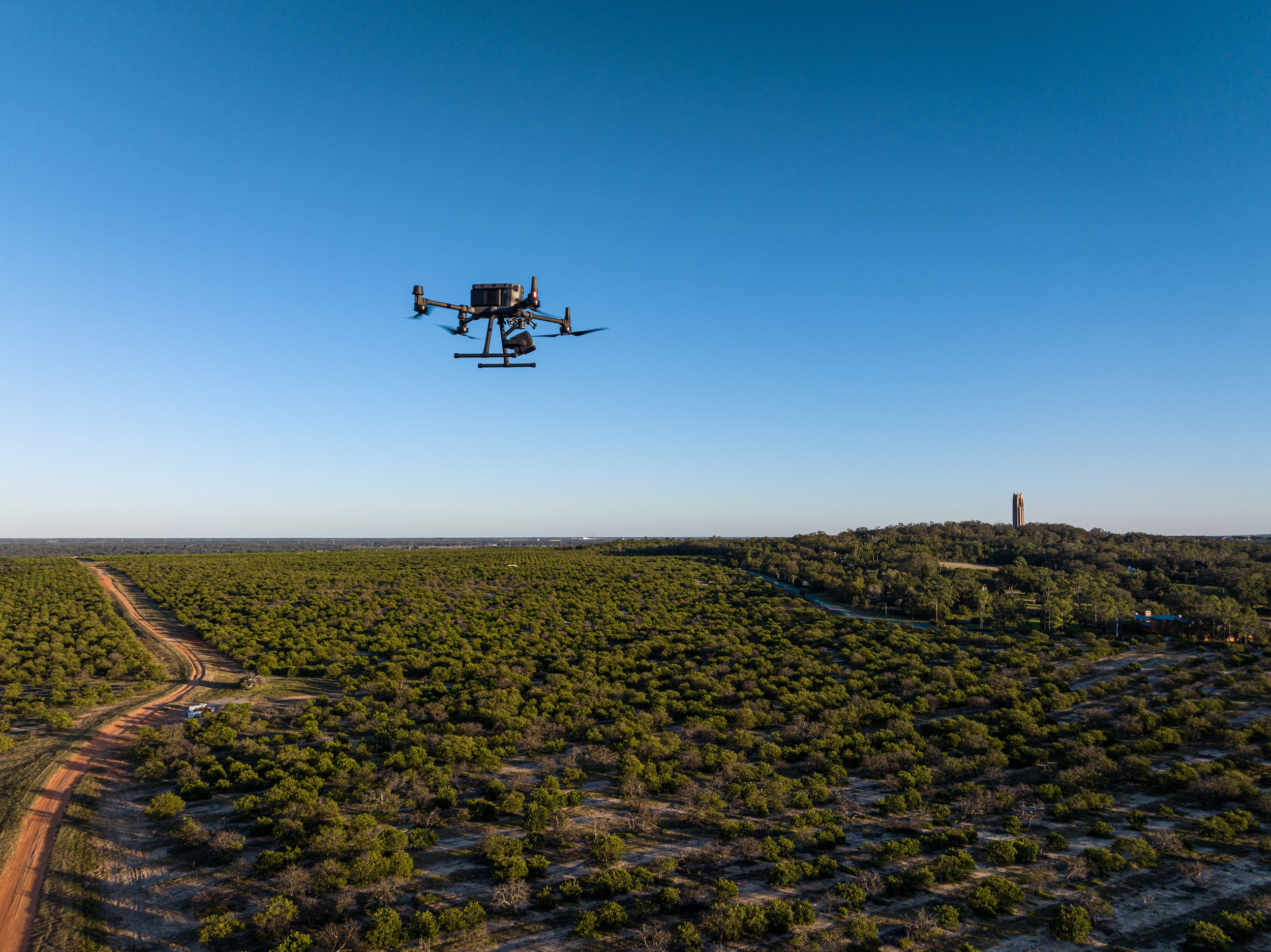
We utilize several UAS drone platforms, allowing us to tailor our approach to each specific project’s needs. We can provide high resolution RGB and multispectral georeferenced orthophotography, LiDAR point cloud products, as well as the more familiar site inspection and promotional photography products. We are fully insured, FAA Part 107 certified, and maintain the highest standards of field procedures for safety, and reliability. By performing all our post-flight processing in-house, including photo editing, LiDAR point cloud processing/feature extraction, and orthomosaic creation, we can provide an efficient and responsive project experience to our customers. When combined with our Survey and GIS capabilities, we can manage every aspect of large-scale aerial mapping from field-to-finish, providing unparalleled performance and end results for your projects.
Our Approach:
-

Precision Orthomosaics and LiDAR Products
We offer unique capabilities for large and small scale projects requiring centimeter-level accuracy for high resolution orthomosaics and LiDAR based topographic products. Combining our survey capabilities with our fleet of drones and sensor payloads, we can be there for every stage of your project.
This process includes establishing precision horizontal and vertical control networks on site, performing the necessary flights to capture RGB and/or multispectral orthoimagery and LiDAR scans with our state-of-the art scanner payload, processing the captured data, and most importantly - performing quality control checks by using other survey methods to ground-truth the captured data.
We feel this sets us apart from other aerial providers who may not be equipped for this last, crucial step. By performing each step of your project in-house, we provide a level of attention to detail that can be hard to accomplish effectively when depending on outside service providers. Our methods have scaled from small, 5 acre projects all the way to 160+ acre development properties and beyond. With these aerial platforms we can safely and efficiently map properties that could otherwise be inaccessible using other survey methods - all while maintaining the level of accuracy and reliability you expect from a traditional survey product.
-

Large Scale Imagery for Planning and Design
An orthomosaic is a detailed, distortion free, two dimensional aerial image, created by stitching a series of individual images that have been corrected for lens distortion, camera tilt, and perspective. Utilizing our twin RGB capable drone platforms and sophisticated processing software, we can cover both large and small scale project areas to produce precision georeferenced orthomosaic images showing up-to-date site conditions for utility corridors, development properties, and many other existing or planned project areas.
These high-resolution, color aerial images are perfect for planning, inventory, and design, and can even be suitable for measurement purposes. By establishing ground control using survey-grade equipment and procedures, our images are typically georeferenced to within a few centimeters of ground accuracy - and in enough high resolution detail to see many utility features, including paint markings, valves, junction boxes, and other objects.
Our clients have utilized these images to get the big picture on highly detailed, large, and difficult-to-access sites for projects like utility route planning, wastewater management planning, demolition planning, site inventory, wetlands identification, and many other applications. When combining our up-to-date orthoimagery with our on-the-ground survey capabilities and GIS mapping expertise, we can provide a wide range of solutions for your project needs.
-

Site Monitoring and Inspections
We also offer image capture services for large scale site monitoring and inspections. Our multi spectral and RGB camera payloads can reveal plant growth patterns in agricultural areas, potentially helping growers identify areas of disease, or poor growth patterns caused by over-wet soil, problems with nutrition, or other issues that can be corrected if caught early. Establishing ground control on site allows us to return to the site and repeat the same flight path as many times as necessary, providing a visual timeline of how your crops are changing and responding over the course of the growing season. Using GIS techniques, we can combine this up-to-date imagery with other useful data from the grower, like planting dates, crop varieties, watering schedules and nutrition changes, to create a visual map to identify patterns and changes over time – providing clients with the perspective they need to make sound business decisions and optimize their investments.
Other similar applications include site monitoring for construction to understand and quantify changes to the project over time, as well as many other types of inspections requiring repeatable, precision measurements especially in large or difficult to access areas. These include roofs, commercial processing plants, utility plants, utility corridors, solar panel farms – and many other applications where reliable, high-resolution, measurement-quality imagery and 3D data can provide the client with greater insight about their assets. And with our GIS expertise, this isn’t limited to just visual data! We can combine images with other data sources to provide a comprehensive overview of your site assets for inventory management, and other applications.
-

Promotional and General Photography
With all of our sophisticated image capture and analysis capabilities, we haven’t forgotten the basics – an aerial platform with a high quality camera system is capable of providing visually stunning images from a unique point of view.
Whether you are looking for promotional images for a project, real estate sale, or any other general photography needs, we have the experience to capture your vision. All the photos you see on this page were captured using our drones. Our staff pilot, Matt, is also an avid landscape photographer in his free time and brings the skills earned from years of photography practice to your images.
We have utilized these skills on some unique projects, including re-creating turn of the century historical images for local municipalities. Let us know how we can help you bring your vision to life!